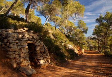
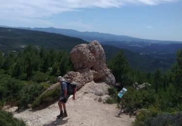
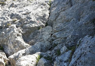
Randonnée Marche Le Tholonet - 13 Tholonet De part et d'autre de la Cause et du Lac Zola - Photo

13 Tholonet De part et d'autre de la Cause et du Lac Zola

 Nathy8913
Nathy8913

Utilisateur

© OpenStreetMap contributors
Longueur
Longueur
12 km
Altitude max
Altitude max
354 m
Dénivelé positif
Dénivelé positif
413 m
Km-Effort
Km-Effort  
17,5 km
Altitude min
Altitude min
179 m
Dénivelé négatif
Dénivelé négatif
413 m
Boucle
Boucle
Oui
Date de création :
2024-06-14 07:26:05.559
Dernière modification :
2024-06-14 07:28:41.427

(0 Avis)

Marche
Marche
3h58
Difficulté : Difficile

Scannez ce code QR pour ouvrir la randonnée dans l'application SityTrail

Application GPS de randonnée GRATUITE

Logo SityTrail SityTrail

IGN / Instituts géographiques

Télécharger SityTrail sur l'App Store Télécharger SityTrail sur Google Play

Logo SityTrail SityTrail World

Le monde est à vous

Télécharger SityTrail sur l'App Store Télécharger SityTrail sur Google Play Télécharger SityTrail sur Huawei AppGallery

À propos

Randonnée Marche de 12 km à découvrir à Provence-Alpes-Côte d'Azur, Bouches-du-Rhône, Le Tholonet. Cette randonnée est proposée par Nathy8913.

Profil altimétrique

Points d'intérêt

Point d'intérêt Le Tholonet - Parking du Tholonet après le pont sur la Cause - Photo
Nathy8913
Point d'intérêt Le Tholonet - Panneau indicateur - Photo
Nathy8913
LE THOLONET 
Point d'intérêt Le Tholonet - Croisement en Y et cairn - Photo
Nathy8913
Point d'intérêt Le Tholonet - Croisement en Y entre 2 cairns - Photo
Nathy8913
Point d'intérêt Le Tholonet - Ancien barrage  - Photo
Nathy8913
LE THOLONET 
Point d'intérêt Le Tholonet - Bifurcation - Barrage Zola - Photo
Nathy8913
Point d'intérêt Le Tholonet - Croisement de trois sentiers - Photo
Nathy8913
Point d'intérêt Le Tholonet - Traversée de la Cause - Photo
Nathy8913
Point d'intérêt Le Tholonet - Croisement en Y - Photo
Nathy8913
LE THOLONET 
Point d'intérêt Le Tholonet - Croisement en forme d'arc de cercle - Photo
Nathy8913
Point d'intérêt Le Tholonet - Bifurcation plein Nord - Photo
Nathy8913
Point d'intérêt Le Tholonet - Montée dans les rochers  - Photo
Nathy8913
Point d'intérêt Le Tholonet - Croisement en Y  - Photo
Nathy8913
LE THOLONET 
Point d'intérêt Le Tholonet - Bifurcation en épingle - Photo
Nathy8913
Point d'intérêt Le Tholonet -  Croisement en Y - Cairn  - Photo
Nathy8913
Point d'intérêt Le Tholonet - Croisement en Y  - Photo
Nathy8913
LE THOLONET 
Point d'intérêt Saint-Marc-Jaumegarde - Croisement en Y - Point commun - Photo
Nathy8913
SAINT-MARC-JAUMEGARDE 
Point d'intérêt Aix-en-Provence - Croisement en X - Point commun - Photo
Nathy8913
Point d'intérêt Aix-en-Provence - Entrée carrières Bibémus - Photo
Nathy8913
Point d'intérêt Aix-en-Provence - Croisement en X - Photo
Nathy8913
AIX-EN-PROVENCE 
Point d'intérêt Le Tholonet - Parking du Tholonet après le pont sur la Cause  - Photo
Nathy8913

Localisation

Pays :
France
Région :
Provence-Alpes-Côte d'Azur
Département/Province :
Bouches-du-Rhône
Commune :
Le Tholonet
Localité :
Unknown
Départ:(Dec)
Départ:(UTM)
702881 ; 4821847 (31T) N.

Randonnées à proximité

Randonnée Marche Aix-en-Provence - Circuit des lacs Zola et Bimont - Aix-en-Provence - Photo
Marche
tracegps

Marche

Moyen
(4)
Aix-en-Provence, Provence-Alpes-Côte d'Azur, Bouches-du-Rhône, France
10 km | 13,6 km-effort
2h 30min
Oui
Randonnée Marche Saint-Marc-Jaumegarde - Barrages Zola-Bimont - Photo
Marche
Berpav

Marche

Moyen
(2)
Saint-Marc-Jaumegarde, Provence-Alpes-Côte d'Azur, Bouches-du-Rhône, France
8 km | 11 km-effort
2h 30min
Oui
Randonnée Marche Saint-Marc-Jaumegarde - La Croix de Provence depuis le barrage de Bimont - Photo
Marche
tracegps

Marche

Difficile
(1)
Saint-Marc-Jaumegarde, Provence-Alpes-Côte d'Azur, Bouches-du-Rhône, France
13,9 km | 24 km-effort
4h 45min
Oui
Randonnée A pied Beaurecueil - Sentier Imoucha - Photo
A pied
GUIDE+

A pied

Facile
Beaurecueil, Provence-Alpes-Côte d'Azur, Bouches-du-Rhône, France
4,4 km | 10,1 km-effort
2h 17min
Non
Randonnée Marche Le Tholonet - Bibemus - Lac Zola 1-1-21 - Photo
Marche
GUIDE
fredetpascale

Marche

Moyen
(1)
Le Tholonet, Provence-Alpes-Côte d'Azur, Bouches-du-Rhône, France
7,6 km | 10,4 km-effort
2h 21min
Non
Randonnée Marche Aix-en-Provence - Aix - Tour César 8/11/2020 - Photo
Marche
GUIDE
fredetpascale

Marche

Facile
(1)
Aix-en-Provence, Provence-Alpes-Côte d'Azur, Bouches-du-Rhône, France
15,6 km | 19,6 km-effort
3h 26min
Oui
Randonnée Marche Saint-Antonin-sur-Bayon - la croix de Provence - Photo
Marche
GUIDE
nadd73

Marche

Difficile
Saint-Antonin-sur-Bayon, Provence-Alpes-Côte d'Azur, Bouches-du-Rhône, France
6,6 km | 14,7 km-effort
5h 11min
Oui
Randonnée Marche Aix-en-Provence - Aix En Provence - St Beaume - Photo
Marche
Geckos

Marche

Difficile
(1)
Aix-en-Provence, Provence-Alpes-Côte d'Azur, Bouches-du-Rhône, France
65 km | 94 km-effort
19h 29min
Non
Randonnée Marche Saint-Antonin-sur-Bayon - Sainte Victoire - Bau Cézanne - tracé jaune - Photo
Marche
GUIDE
amiral13

Marche

Difficile
(1)
Saint-Antonin-sur-Bayon, Provence-Alpes-Côte d'Azur, Bouches-du-Rhône, France
5,3 km | 12,2 km-effort
2h 28min
Oui


Fermer
Mes abonnements